1 引言
2 天气形势和资料选取
2.1 天气形势
2.2 资料选取
3 大尺度环流背景
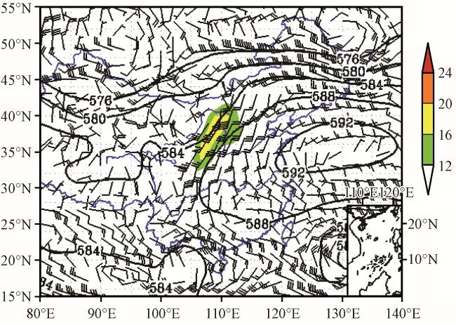
图2 “7·19”暴雨过程08:00高空综合图黑线为500 hPa位势高度(单位: dagpm); 阴影为700 hPa≥12 m·s-1低空急流(单位: m·s -1); 风羽为850 hPa风场(单位: m·s-1) Fig.2 Comprehensive field of high level at 08:00 on 19 July 2018.The black line represents potential height at 500 hPa(unit: dagpm); The shadow represents the jet of 700 hPa≥12 m·s -1(unit: m·s-1); Barbs represents 850 hPa wind field(unit: m·s-1) |
4 暴雨的成因
4.1 充沛的水汽
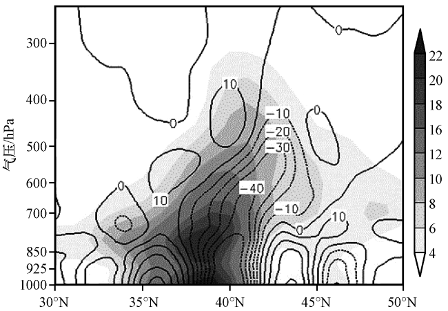
图3 “7·19”暴雨过程08:00水汽通量[阴影, 单位: g·(cm·hPa·s)-1]及其散度(黑线, 单位: ×10-6 g·s-1·cm-2·hPa-1)沿110.05°E剖面Fig.3 The profile of water vapor flux field [the shaded, unit: g·(cm·hPa·s)-1)] and its divergence field (black line, unit: ×10-6 g·s-1·cm-2·hPa-1) along 110.05°E at 08:00 in “7·19” heavy rainstorm |
4.2 大尺度上升运动
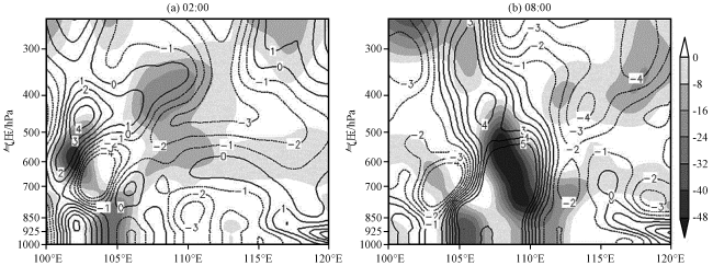
图4 “7·19”暴雨过程02:00和08:00涡度(等值线, 单位: ×10-5 s-1)、 散度(阴影, 单位: ×10-6 s-1)沿41.03°N剖面Fig.4 The profile of vorticity field (contour, unit: ×10-5 s-1) and divergence field (the shaded, unit: ×10-6 s-1)along 41.03°N at 02:00 and 08:00 in“7·19”heavy rainstorm |
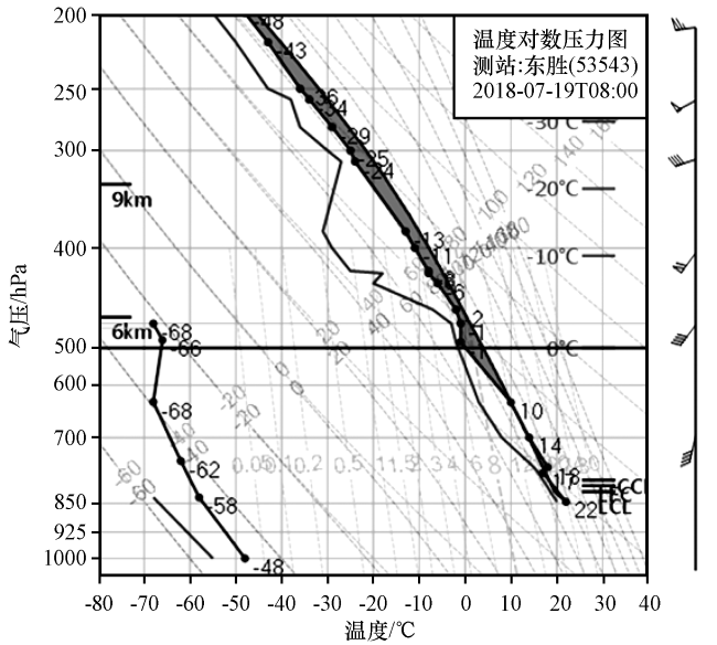
4.3 垂直不稳定层结
4.4 “列车效应”触发机制
4.4.1 阴山山脉特殊地形的强迫抬升
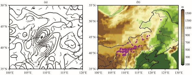
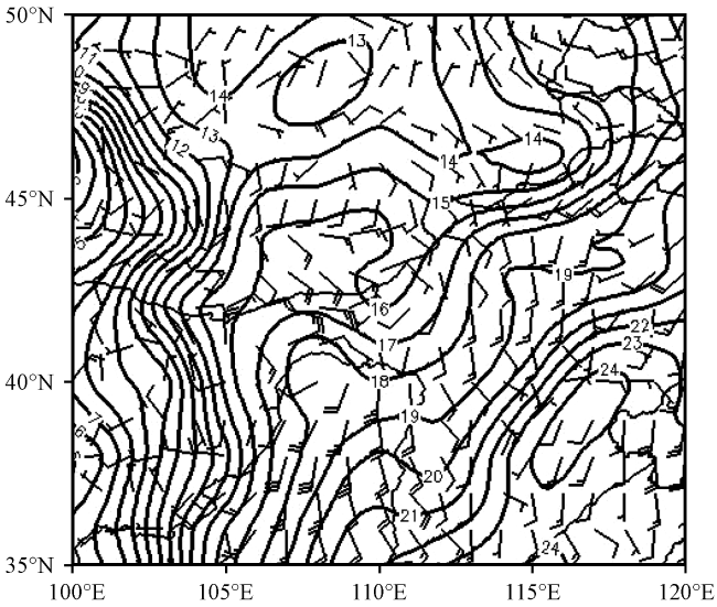
图8 “7·19”暴雨过程19日08:00 850 hPa风场(风羽, 单位: m·s-1)和散度(黑线, 单位: ×10-6 s-1)(a), 18日20:00至19日20:00 24 h降水量≥50 mm的气象观测站点分布(b, 阴影: 地形高度, 单位: m)Fig.8 Wind field at 850 hPa (barb, unit: m·s -1) and divergence field (black line, unit: ×10-6 s-1) at 08:00 on 19(a), and the distribution of observation stations with ≥50 mm precipitation from 20:00 on 18 to 20:00 on 19 (b, the shaded: terrain height, unit: m) in “7·19” heavy rainstorm |