Not found "Train Effect" in the formation process of heavy fainfall

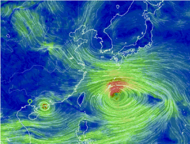
在气象学中,温室效应和蝴蝶效应可能是最大众化的术语了,但其实,气象学中的“效应”除了这两个以外,还有不少值得了解的,远的不说,2021年7月20日河南出现持续性强降水天气中就能见到 “效应”的身影,那就是“列车效应”。

那么,何为列车效应?它的威力又如何呢?

试想,当一个人站在铁轨旁边,一列列火车经过时,会有什么感受?火车有很多节车厢,当其经过时,肯定是很多节车厢一节一节地经过,而此时,站在铁轨边的人会接连不断地感受到一节节车厢经过时带来的巨大声音和冲力。一列火车尚且如此,连续不断的火车经过则更是“变本加厉”了。

现在,将列车效应与降水相联系,就如同排列成串的对流云降水,每一朵对流云(被称为对流单体)都会产生短时强降水。而当多个对流云团依次经过某一地区的上空时,其所产生的降水量累计起来,就会导致大暴雨甚至特大暴雨,这就是降水列车效应的通俗解释。

值得一提的是,列车效应在引发短时强降水和暴雨方面也有所不同。

其实,列车效应是短时强降水与暴雨之间重要的联系桥梁。从暴雨和短时强降水之间的区别看,短时强降水强调的是强度,暴雨则强调累计值,即累计降水量,而二者之间又是紧密相连的,这其中就有列车效应的贡献,可以说,短时强降水不一定形成暴雨,但在列车效应下的短时强降水过程往往导致暴雨,甚至特大暴雨。

为了使大家更清晰地了解“列车效应”,更客观地认识暴雨天气的形成过程与列车效应的欢喜,《高原气象》特整理了“暴雨形成过程之列车效应”虚拟专刊,以供大家对列车效应有一个初步的了解。


Default Latest Most Read  
Please wait a minute...
For Selected: Toggle Thumbnails
  • Causes of a Torrential Rainstorm Induced by “Train Effect” in Hetao Area
  • Guilian ZHANG;Yuehe HANG;Lijuan FU;Lu ZHANG;Fuxiang BAO
  • 2020, 39 (4): 788-795. DOI: 10.7522/j.issn.1000-0534.2019.00122
  • Abstract (777) HTML (576) PDF (7017KB)(361)
  • Using the 24 h and 1 h precipitation data of 785 automatic weather stations provided by the Inner Mongolia Autonomous Region Meteorological Information Center and the Ordos (CINRAD/CB) Doppler radar data from the Hetao area of Inner Mongolia, the FNL of NECP (1°×1°) 6 h reanalysis data and global topographic (1°×1°) data, we analyzed the torrential rainstorm in Hetao area, Inner Mongolia from 18 to 19 July 2018.The results show that the stable and less moving subtropical high with its northwest trough at 500 hPa, the “herringbone” shaped shear line in middle and lower level, and low-level jet are the main background.The condition of water vapor during the rainstorm period presents strong southwest branch water vapor transport and vertical convergence ascending motion, and water vapor flux intensity center develops up to 700 hPa with vertical convergence of water vapor flux rising to 500 hPa.The “train effect” disturbances induced by the orographicforcing of the Yinshan mountain continuously and propagating over the rainstorm area, which are characterized by significant east-west axial band echoes in Radar reflectivity, is the key of the dynamic process for the persistent rainstorm.Furthermore, the quasi-positive pressure instability structure with the positive vorticity center and the negative divergence center coincide over the rainstorm area exacerbates the development of convective instability.
  • The Mesoscale Characteristics of Extreme Rainstorm in the Eastern Region of Helan Mountain
  • Yuying CHEN;Yang SU;Yin YANG;Suzhao ZHANG;Jing YANG
  • 2021, 40 (1): 47-60. DOI: 10.7522/j.issn.1000-0534.2020.00012
  • Abstract (768) HTML (368) PDF (13602KB)(390)
  • Using high-resolution multi-source data such as the hourly precipitation of automatic weather stations in the past 10 years, Yinchuan CD radar, Temperature of Black Body of FY-2 satellite, radiosonde data and ECMWF reanalysis data (0.125°×0.125°), the mesoscale characteristics of six extreme rainstorms in the Eastern Region of Helan Mountain were analyzed based on the classification of mesoscale systems.The rainstorm dominated by linear convection system is deep convection, while the rainstorm dominated by nonlinear convection system is mixed convection.The results show that: (1) The low-level southeast jet enhances and triggers meso-micro scale rainstorm systems in the eastern slope of Helan Mountain at night, leading to the extreme rainstorms are convective rainstorms with short-time heavy rainfall.The rainstorm is mainly concentrated in the eastern slope of Helan Mountain especially centralizes in the mouth of shanhong ditch with remarkable characteristics of night rain.(2) All the extreme rainstorm environment fields meet the three basic conditions of convective rainstorm.Low-level southeast jet at 700 hPa transports warm and moist flow to heavy rainfall areas, which promotes the atmospheric static instability, dynamic, thermodynamic and topography lifting trigger mechanism.There is no obvious low-level jet at 850 hPa in the rainstorm dominated by deep convection system.Vapor source is the Bay of Bengal.Limited water vapor transport condition but lower atmospheric stability is more favorable to convective rainstorm.However, the path of low-level jet at 850 hPa coincides with low-level southeast jet at 700 hPa in the rainstorm dominated by mixed convection system.Moisture transport from the Bay of Bengal, the South China Sea, the Yellow Sea and the Bohai Sea are the source of the extreme rainstorm.The more moisture transport contributes to sustained rainstorm.(3) Extreme rainstorm is mainly divided into convective precipitation in the warm zone of front, frontal convective precipitation and stratiform precipitation of frontal zone.Convective precipitation in the warm zone of front mainly occurs in the mountain areas, and its trigger mechanism is topographic uplifting.Frontal convective is triggered by warm and moisture flow lifted on the cold surface, and it could occur in plains and mountains.The movement of convective system is consistent with lower wind field.It propagates along mountain in the mountain areas but along the low-level jet in plains.Usually the movement of convective system is parallel to the direction of propagation.However, when the lower level dominated by east wind in the mountain areas, it moves approximately perpendicular to the direction of propagation with obvious train effect.(4) There is a weak cold air in linear convective rainstorm, and the types of rainstorm are mainly convective precipitation in the warm zone of front and frontal convective precipitation.Convective system propagates along the mountain and form the linear zonal echo with high degree of organization, its movement could be parallel or perpendicular to the direction of propagation.It develops strongly and maintains a long time in front of the mountain affected by topographic uplift.So the rainstorm has features such as the short duration, the small range, the great rainfall intensity and the intermittent precipitation.Cumulative rainfall of 3~4 h of rainstorm accounted for about 85% of the total amount of the process, and the area mean rainfall is much smaller than heavy rain magnitude, which reflects the feature of topographic strong convective rainstorm.(5) Cold air is active in nonlinear convective precipitation.It is dominated by frontal convective precipitation and stratiform precipitation of frontal zone.Convective system propagates along the mountain in the mountain areas and along the jet stream axis in plains, forming the nonlinear echo.It moves parallel to the direction of propagation in plains while its movement could be parallel or perpendicular to the direction of propagation in the mountain areas.Convective system moves quickly with weak intensity and low degree of organization.Rainstorm has features such as the long duration, the large range, the small rainfall intensity, the continuous precipitation and the large cumulative rainfall.The area mean rainfall is close to or equal to the heavy rain magnitude.It has the remarkable characteristic of mixed precipitation.(6) The precipitation intensity is positively correlated with CAPE amplification, echo intensity, duration of strong echo, echo tops and vertically integrated liquid, but negatively correlated with TBB.Correlations are clearer in rainstorm dominated by linear deep convection.The positive correlation between precipitation intensity R and echo intensity Z is the most significant when the echo intensity is more than 40 dBZ (R=3.67×10⁻⁸×Z 5.222+4.835).
  • The Formation of an Unusual Two-belt Heavy Rainfall around Beijing-Tianjin-Hebei Area
  • WANG Hua;LI Hongyu;ZHONG Jiqin;WU Jin;LI Ziming;WU Jiankun
  • 2019, 38 (4): 856-871. DOI: 10.7522/j.issn.1000-0534.2018.00102
  • Abstract (597) HTML PDF (39526KB)(412)
  • Heavy rainfall is one kind of extreme weather which is harmful to human beings. Since the formation mechanism of heavy rainfall is very complicated, it brings great challenge to weather forecasting and warning. An unusual double-belt heavy rainfall with high precipitation intensity and long-duration precipitation happened on July 1st 2013 around Beijing-Tianjin-Hebei area, under the synoptic background of northwards stretching subtropical high, southwards strengthening low-level jets, and eastwards moving upper trough. The formation mechanism and mesoscale characteristics of this case is analyzedbased on conventional observation, NCEP (National Centers for Environmental Prediction) reanalysis data, multi-type of intensive observation, and the variational radar data assimilation. The result shows that thosetworainfall belt promote mutually, although their formation mechanism and mesoscale evolution differ obviously. The south branch heavy rainfall belt occurred under the strengthened southwest warm and moist environment, with high convective instability and deep moist layers. The heavy rainfall is triggered, organized by the warm mesoscale convergence line and developed by MCC(Mesoscale Convective Complex). The radar echoes of the rainfall is characteristic of "train-effect" and backpropagation. It is a deeper warm-zone wet convection rainstorm with extremely high rainfall intensity, large amount of accumulated rainfall, and obvious mesoscale features. The location of rainfall belt and the extremely intensive precipitation core is dominated by the position of the surface convergence line and the mesoscale eddies. Propagating direction of the intense radar reflectivity is indicated by the cold pool outflow generated by heavy rainfall together with the maximum temperature gradient formed by the southerly warm and wet airflow. The north branch heavy rainfall belt is brought about by multi-cell echoes belt formed by shearline cloud system, under the influence of cold shear line and low-level low vortex. It sinstability energy is lower than that in the south branch heavy rainfall belt, but the upward motion is stronger thanks to the coupling action of the upper and lower synoptic systems. Intrusion of dry and cold air in middle layer forms an obvious θse frontal zone. It is a frontal convective system. Meanwhile, the terrain helps to enhance precipitation markedly. Various factors jointly make the case be characteristic of relative weak rainfall intensity, long-lasting precipitation and large area with heavy rain. The moving path of the low-level low vortex is well consistent with the location of the rainfall belt and heavy rainfall region. The easterly wind induced by warm-zone precipitation within the south branch heavy rainfall belt not only brings water vapor to the north branch rainfall belt but also the orographic lifting made by the Taihang mountain benefits the occurrence and development of those severe convection cells, which furtherly enhance the rainfall intensity of the north branch rainfall belt. On the other hand, the cold pool formed by severe convective rainfall accelerates the formation of surface mesoscale eddies, which cause intense convective radar echoesmergence and strengthen the rainfall again at the later stage of the south branch rainfall belt.
  • Analysis on Mesoscale Characteristics of a Rainstorm Process in Southeastern Gansu
  • WANG Baojian;KONG Xiangwei;FU Zhao;HUANG Yuxia
  • 2016, 35 (6): 1551-1564. DOI: 10.7522/j.issn.1000-0534.2015.00114
  • Abstract (425) HTML PDF (23191KB)(1903)
  • A rare torrential rainfall process which show the long lasting, strong concentrating and obvious mesoscale characteristics attacked southeastern Gansu province on 19-20 June 2013. This rainfall process consisted of 76.8% warm-area precipitation and low-level shear line precipitation. The causes of torrential rainfall and characteristics of mesoscale system are studied in detail by using conventional and unconventional observation data, NCEP reanalysis data, satellite data and Tianshui radar data. During the period of warm-area precipitation, it shows that the related circulation patternare similar to the typical circulation patternin this area. However, thelow-level wind shear shifts westward and the rainfall area isaffected by the warm air. High temperature and high humidity in the low level reduce the LCL and LFC height and weaken the lifting condition, corresponding withthecold trough in the middle level and then forming theunstable stratification. Besides, the low-level temperature inversion in the early stage isalso conducive to the accumulation of unstable energy. On the other hand, the low-level vertical wind shear, jet stream, and the effect of terrain elevation arelikely to play an important role in triggering and maintaining the convection there. The Strong convectioncorrespondsto the low-level jet stream. The convective cells mainly generateoverthe Huixian-Chengxian basin. The mesoscale convective system showthe characteristics of warm cloud precipitation, low-mass center, high efficiency, backward propagation and train effects. During the period of low-level shear line precipitation, the Wudu vortex located overthe northeast Qinghai-Xizang Plateau developsand strengthensdue to the warm advection, positive vorticity advection in the middle level, and low-level cold air intrusion. Besides, the thickness of wet layer increasesin the troposphere, and the thermal instability condition diminishessignificantly. As a result, the low-level shear line, vortex, and the ground convergence line formthe synoptic-scale upward movement, causing a wide range of stability precipitation. For both the warm-area precipitation and low-level shear line precipitation, there showthree obvious water vapor transportation channel in the lower troposphere:around the east of the Qinghai-Xizang Plateau from the bay of Bengal, through Central China from the South China Sea, and through East China from the east coast. Warm and moist air areconstantly transported to the torrential rainfall area from the tropical and subtropical and result thewater vapor convergence.
  • Analysis on Mechanism of Mesoscale Rainstorm Triggered by Quasi-Stationary Dryline in Boundary Layer
  • WANG Xiaoling;WANG Haiyan;WANG Shanshan;WU Cuihong;ZHANG Pingping
  • 2015, 34 (5): 1310-1322. DOI: 10.7522/j.issn.1000-0534.2014.00056
  • Abstract (241) PDF (13627KB)(638)
  • NCEP GFS reanalysis data with the satellite,radar,automatic station and synthetic diagnosis method were used to analyze ten mesoscale rainstorms triggered by quasi-stationary in boundary layer.The results showed that this type rainstorm often happened in warm area, having strong instability energy the rainstorm center was small and stable while the precipitation time was longer.Generally, it's rainfall intensity was between 30 mm and 50 mm.The dynamic mechanism can be drawn as follows.Positive vorticity advection on 500 hPa extending to rainstorm area, enhanced cyclonic vorticity in boundary layer, positive vorticity advection column developed.Meanwhile, with the development of northerly significant flow in boundary layer, dry and wet advection enhanced at two sides of dry line respectively, dry air was involved in wet air, produced local frontogenesis, and small perturbation were produced due to dipole distribution of positive and negative temperature advections in boundary layer, lead to ascending motion enhancing.The average air flow was consistent with the moving direction of the convective system, high temperature and humidity instability region was located in the upper reaches of the convective system, so the convective motion of the system is obviously backward propagation, the new convection monomer linear and followed by the same position, lead to the train effect, conducive to the precipitation in the same place long time maintenance.The rainfall region was discovered that wet tongue tip on the south side of the dry line in boundary, and close to warm moist side of the zero line of temperature and humidity advection.
  • Baidu(3)
  • Study on Structure Characteristic of Southwest Vortex Accompanying with Heavy Rainstorm in East Sichuan Basin
  • JIANG Yu-hua-;DU Qin;ZHAO Da-jun;HE Yue;LI Jiang
  • 2012, 31 (6): 1562-1573.
  • Abstract (299) PDF (2039KB)(1209)
  • Based on daily precipitation datasets from 1951 to 2008 at 54 stations in east Sichuan basin(27°-32°N, 105°-110°E), the results of the daily precipitation statistics show that the heavy rainstorm with storm, hail and strong wind usually occurs from June to September. The high incidence area of single station rainstorm is in the Northeast of Sichuan and Chongqing. Frequent occurred area of regional heavy rainstorm is in the western of Chongqing and southeast of Sichuan. Using the observational data and NCEP/NCAR 1°×1° reanalysis data, selecting sixcases with regional heavy rainstorm processes in Yibin, Nanchong and west of Chongqing from 2007 to 2010, using the composited method, an analysis is made for the dynamic and thermal structure and moisture conditions of the influence system which promotes the occurrenceand development of Southwest Vortex (SWV). The results show that asdevelopment of SWV, the air column is warmed obviously on 200 hPa, but it turn partlycold, the convective instability is obvious. As well as a trough moves eastward on 500 hPa, the positive vorticity enhances and extends from the lower troposphere to 300  hPa and it inclines westwardlywith the height. That severe precipitation happened accompanying with the formation of upper-level jet on 200 hPa with the intersectional region of the southward strong wind and the northward one is located in 105°-107°E and 28°-30°N in the lower troposphere (low-level jet). In the mean while, the water vapor is transported from southeast to northwest significantly. The characteristic of satellite cloud image appears to be MCC, the Doppler radar echo feature is mesocycloneand ‘traineffect’ of SWV.
  • Baidu(14)
  • Analyses on Triggered MCC Evolution Process and Structural Characteristic in a Heavy Rainstorm in Guangxi
  • 黎惠金;李向红;黄芳;李江南;覃昌柳
  • 2013, 32 (3): 806-817. DOI: 10.7522/j.issn.1000-0534.2012.00074
  • Abstract (454) PDF (2144KB)(1008)
  • Using the CINRAD-SA Doppler radar data, Micaps conventional weather chart, NCEP data, and FY-2C satellite products, a heavy rainstorm produced by mesoscale convective complex in Guangxi in early June 2010 is analyzed. The results show that:  (1) The predominate influencing system of this case is 850 hPa vortex and shear line, 500 hPa plateau trough and surface stationary front. The stronger energy front, obvious convective unstable stratification on middle and lower levels, and the upper-level θse being downward extension and showing funnel-shaped distribution, and apparent moisture front are the favorable weather model of mesoscale convective system, and high CAPE, lower free convection height, high humidity on lower level, high vertical wind shear are favorable to the occurrence and development of heavy precipitation supercell. (2) The MCS cloud of mesoscale convective system slowly moving southeast from western Guizhou to Hechi and the northwestward MCS cloud in southeastern Guangxi combines  in Central Guangxi to develop the mesoscale convective complex, which slowly moves eastward after the long time stagnation, the southward is the main cloud image characteristics in the heavy rainstorm process. (3) Radar data analysis shows that a wide range of laminated hybrid rainfall echo range is formed in central and western regions of Guangxi during the rainstorm process,  which have a lot of convective storm development on inflow side of strong echo belt, and strong echo belt that is stability and few changes of long-time and post-train are important reason to produce heavy rainfall and strong lightning in the central and western regions of Guangxi. The heavy precipitation supercell storm in Laibin is low-quality mind convective system. At the development stage, the storm shows a supercell storm hook echo structure, and contains a low-level weak echo  and associated front ‘V’ notch echo, and a weak mesoscale cyclone in the corresponding radial velocity image; at the strong phase, the storm is wavy, reflectivity factor from low to high inflow to the lower slope,  being ‘V’ notch echo on the right front and left rear side, the lower inflow side in the front ‘V’ notch echo of the storm, and it is a medium strength and well-developed mesoscale cyclone in the corresponding radial velocity image, being strong sinking inflow in the back of the storm.
  • Baidu(7)
  • Frontogenesis Process and Slantwise Vorticity Development of a Rainstorm Process in the Eastern Gansu
  • WANG Fucun;XU Dongbei;YAO Yanfeng;XIU Shaoyu;GUO Pingping;QUE Longkai;HAN Shupu
  • 2016, 35 (2): 419-431. DOI: 10.7522/j.issn.1000-0534.2014.00127
  • Abstract (344) PDF (10767KB)(860)
  • By using the data of sounding and surface intensive AWS, the satellite cloud images, the Doppler weather radar and the reanalysis data of ECMWF (ERA-interim) 0.25°×0.25°, the frontogenesis process and slantwise vorticity development of a rainstorm occurred on 20 June 2013 in the eastern Gansu are analyzed. The results show that the strong frontogenesis is caused by interaction among the shear line in lower troposphere, subtropical high, and the cold air in the middle and lower troposphere in the northeastern side of the plateau. The frontogenetical forcing causes rapid development of vertical vorticity and convergence in the shear line, triggering the release of unstable energy to generate strong convection and rainstorm. The rainstorm occurs beneath strong convective cloud of TBB<-52℃. Rain intensity changes from weak to strong with the cold air southward invading and infiltrating in the eastern Gansu, however, that begins to weaken after entering the Sichuan. The height of radar strong echo is below 5 km and 0℃ layer, it has characteristics of low center of mass and high efficiency precipitation echo. The strong echo moving from south to north has the train effect. The intensity changes of frontogenesis, shear line and rainfall are consistent. The frontogenesis function analysis indicated that enhancement stage in the rainstorm, effects of divergence and deformation play the main role and effect of deformation is more obvious, however, effect of tilting term is relatively small. The continuous stage in the rainstorm, effects of divergence and deformation are equal in match or contest of strength, effect of tilting term is frontolysis. Through the complete form of vertical vorticity tendency equation established the direct connection between the vertical vorticity change and frontogenesis, to diagnose the frontogenesis effect on the intensity of the weather system. The frontogenesis tilts the wet isentropic surface and produces significant positive vertical vorticity change in front of the frontal zone, which results in the fast development of shear line.
  • Formation Mechanism and Analysis of Radar Observation of a Heavy Rainstorm Accompanied by Hail that Back of Trough
  • ZHANG Yiping;YU Xiaoding;SUN Jinglan;LIANG Junping;LI Zhou
  • 2014, 33 (4): 1093-1104. DOI: 10.7522/j.issn.1000-0534.2012.00200
  • Abstract (265) PDF (13329KB)(849)
  • Using the conventional observation, new generation weather radar, AWS, NCEP data, the weather formation mechanism of a local heavy rainstorm accompanied by repeatedly hail under the northwest flow situation and the structure of mesoscale convective system were detailed analysed. The results showed that: (1)The local heavy rainstorm accompanied by hail occurred in the situation of northwest airflow and atmospheric stratification was very unstable. The value of CAPE at 14:00(Beijing time, hereafter the same) was significantly increased compared to that at 08:00,which provided instability energy for heavy rainstorm and hail; The large value center of water vapor content in the lower-troposphere provided adequate moisture conditions for newborn monomers that generated continued by forward propagation and backword propagation. Local heating of the ground was uneven, the ground temperature reached to the threshold of the convective temperature in the afternoon which made the ground warm air mass free up, and resulted in the initial convective echoes, when it reached thermal convection conditions, the ground mesoscale convergence line and dew-point front for local heavy rainstorm and accompanied by many times hail weather had strengthening and triggering effect. Mesoscale low pressure on the ground was the important reason for convergence maintained and water vapor concentration. (2)On the chart of radar, in the process of the initial echo generated in Zhoukou nearby, strengthened and moved to south-east direction, γ-scale convective cells constantly generated at the rear and right rear of that, the new generated cells experienced the phase of cumulus clouds formed and strengthened, matured and merged, weaked and dissipated. Its direction of propagation and movement closed to opposite, which made the strong echoes near Zhoukou were the state of quasi-stationary dynamic equilibrium and constantly persistent. Subsequently, new meso-γ-scale convective cells were constantly generated in the front side of the band echo that nearly east-west from Xuchang to Taikang, And it linked to the convective cells of backward spread near Zhoukou, and arrayed into northwest-southeast linear multi-cells echo bands. Forward propagation and backword propagation respectively experienced back weakened and front weakened stages. And the middle echo near Zhoukou developed the most productive. The meso-γ-scale convective cells in the multi-cell structure of two forms of forward propagation and back propagation formed a remarkable ‘train effect’, which made local heavy rainstorm with repeatedly hail weather happened in Zhoukou and Xihua. The charts of average radial velocity contained mesoscale vortex, and the northwest-southeast linear convection echo bands had the structural features of convergence, divergence and convergence alternated in the middle and lower layers. The upper layer was opposite with the middle and lower layers. The formation and evolution of linear thunderstorm system were larger related with that downdraft uplifted warm and humid air of severe thunderstorm. The convective cells were generated in the low-level that appearred convergence, and the upper level that appearred divergence.
  • Baidu(18)
  • Analysis of a Meiyu-Front Rainstorm Caused by ‘Train Effect'
  • SUN Suqin;ZHEN Jin;ZHI Shulin;XU Aihua;CHEN Yunhui;SHEN Zhijun;YU Aibin
  • 2015, 34 (1): 190-201. DOI: 10.7522/j.issn.1000-0534.2013.00146
  • Abstract (357) PDF (17895KB)(777)
  • Using Micaps, Doppler radar data and NCEP reanalysis data, the rainstorm occurred in the north of Jiangxi with the rainfall exceeding the history extreme value on 14 June 2011 was analyzed. Synoptic scale systems、mesoscale systems、microscale systems and their relationship of the rainstorm were also analyzed. It is shown that: The main impact system of this extreme precipitation are the south trough, Mid-level dry air intrusion, the strong low level jet(LLJ), the coupling of high and low level jet stream and the maintenance of the surface convergence line. Due to the low mass center structure、strong vertical development and high efficiency of precipitation strong echo through the same area continuously, the ‘train effect' was occurred in the short-duration rainstorm. Meanwhile, the radar echo which was similar to tropical heavy synoptic scale systems had the characteristic of the backward propagation. There was the characteristic of frontal passage in the speed image, and the speed image with a ‘bull eye' structure shows that there was a low level southwest jet. When the direction of the warm and humid Jet was paralleling to the trend of the ground convergence lines, the ever fount vapor from the Bengal reached the convergence lines along the southwest airflow of the trough, and the convergence lines were stable, maintained and developed. Dry cold air invasion prompted the occurrence of the microscale and mesoscale system in the heavy precipitation. The development of the large wind velocity zone and the convergent region were favorable to the maintenance and development of the microscale and mesoscale convective cells and their sub-vertical circulation, thus the ‘train effect' can be maintained. The activity of organized multi-cell storm, the ground quasi-stationary front and the mesoscale lines which maintained for a long time are the main causes for the formation of ‘train effect'. The precipitation echoes move along with the CAPE center, and the special terrain is also one reason of the ‘train effect'.